New Forest District
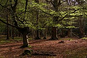
Non-metropolitan district in EnglandNew Forest is a local government district in Hampshire, England. Its council is based in Lyndhurst, although the largest town is Totton. The district also includes the towns of Fordingbridge, Lymington, New Milton and Ringwood. The district is named after and covers most of the New Forest National Park, which occupies much of the central part of the district. The main urban areas are around the periphery of the forest. The district has a coastline onto the Solent to the south and Southampton Water to the east.
Read article


Top Questions
AI generatedMore questions
Nearby Places
New Forest
National park in southern England

Minstead
Village and parish in Hampshire, England

Bolderwood, Hampshire
Part of the New Forest, Hampshire, England

Knightwood Oak

Allum Green
Hamlet in Hampshire, England

Portuguese Fireplace
War memorial in Hampshire, England

Emery Down
Village in Hampshire, England

Christ Church, Emery Down
Church in Emery Down, Hampshire, England